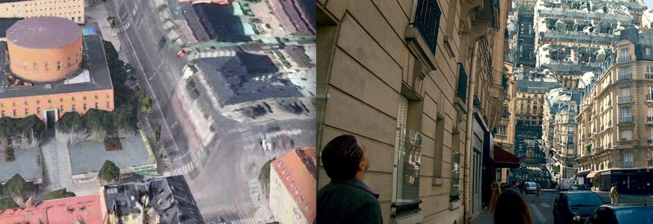
The iOS6 update for the iPhone no longer includes Google Maps, but Apple's own more inferior service. But the accuracy of its data, has a curious beauty to it: the Amazing iOS6 Maps has found a stunning number of melting landscapes. For example this image, compared the streets in Inception folding up like a draw bridge:
Last month, artist Clement Valla explained in his essay for Rhizome how this occurs on Google Earth:
At first, I thought they were glitches, or errors in the algorithm, but looking closer, I realized the situation was actually more interesting — these images are not glitches. They are the absolute logical result of the system. They are an edge condition—an anomaly within the system, a nonstandard, an outlier, even, but not an error. These jarring moments expose how Google Earth works, focusing our attention on the software. They are seams which reveal a new model of seeing and of representing our world - as dynamic, ever-changing data from a myriad of different sources – endlessly combined, constantly updated, creating a seamless illusion...