Mental Maps and the Networked Urban Space
Transit by KLAUS FILIP & NICOLAJ KIRISITS :: There is no doubt that within a few years urban space will be fiilled up with invisible data. Digital Communities will be located in real space. The internet will be extended by a geospatial network. All you'll need is a mobile interface (cellphones) to get involved with the communities / information / networks at certain places within the city. But what does that mean for the face of the city?What kind of mental map will we have from the geospatial networked based urban space?
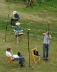
As Kevin Lynch (1960, the image of the city) researches the legibility of urban space, Transit tries to find out the legibility of digital communities in urban spaces. For that proposition we built up an example of this digital urban space on a free field at the Kleyehof (Burgenland) with 25 invited Media artists. The Elements of that digital sculpture were text, video, sound and digital code, spatial located by using gps tools. The grid elements could be connected, to set up different networks.
The Objects are based on a spatial Masterplan, situated in a 3D grid of 1 to 1 to 1 meter; 20 meters long, 20 meters wide and 3 meters high), which defines private area (everyone can see-hear what you do but only you can change it), public (everyone can schange the data), and free spaces.
Transit was part of the podspot project at the University of applied arts vienna / department of digital art. [via Rhizome]
Originally posted on networked_performance by jo