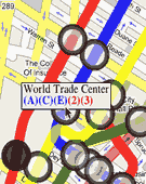
Have you ever longed for a way to make maps of your favorite skating rinks? Or perhaps you need a scaled index of all the artists' homes in your hood. The emergence of networked Geographic Information Systems (GIS) and the increased accessibility of Global Positioning Systems (GPS) are contributing to a growing number of do-it-yourself cartographers. With simple devices that many of us already use regularly, such as camera phones, websites and blogs, any mapping novice can 'geocode' their digital photos, placing them on a map according to their assigned latitude and longitude. Of course, many people, including artists, are always looking for and developing novel ways to manipulate and augment available tools. Google's mapping service and its available API (application programming interface) has quickly become a popular tool for mapping geeks and newbies alike, and with the recent introduction of VGMap, there is one more way for people to utilize the Google tool. Developed by Michael Frumin, Eyebeam R&D's Technical Director, VGMap is a downloadable Flash library that allows those so inclined to link vector graphics to Google-generated maps, something not supported by the mapping system itself. Functional, utilitarian applications will no doubt abound thanks to VGMap, but those psychogeographers and critical mappers among us now have a new tool too. - Ryan Griffis
